 As an avid virtual globe-trotter I was very happy to hear about Google’s addition of the 360Cities.net to Google Earth’s layers. 360Cities.net is a community of photographers that submit high resolution 360 degree panoramic images of locations throughout the world. The images are denoted by 360 in a red circle. When you click on one of the icons an information bubble will appear, to open the image full-screen click on the image in the bubble.
You can also check out the screenshots below to become familiar with the new layers. of the newest layers that Google has added to Google Earth

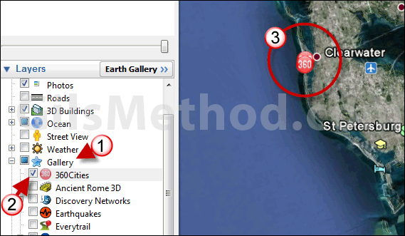
1. When you launch Google Earth click to expand the Gallery layer group.
2. Check the 360 Cities to activate the layer.
3. When the layer loads you will be able to view the 360 Cities images by clicking on the 360 icon on the map.
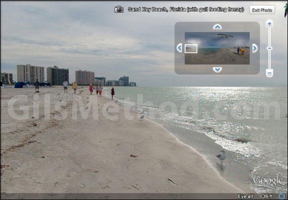
The image will load when you click on the pop-up for a full-screen view.

Use the controls on the top right corner of the picture to navigate the 360 degree view. When you are done viewing the panorama, click on the Exit Photo button.
How do you like 360 panoramas in Google Earth?


